


DOWNING - V 1 Voting District, Dunn County, Wisconsin
About
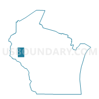
Outline

Summary
| Unique Area Identifier | 693581 |
| Name | DOWNING - V 1 Voting District |
| County | Dunn County |
| State | Wisconsin |
| Area (square miles) | 2.96 |
| Land Area (square miles) | 2.96 |
| Water Area (square miles) | 0.00 |
| % of Land Area | 100.00 |
| % of Water Area | 0.00 |
| Latitude of the Internal Point | 45.04976270 |
| Longtitude of the Internal Point | -92.12432750 |
Maps


Graphs
Select a template below for downloading or customizing gragh for DOWNING - V 1 Voting District, Dunn County, Wisconsin


Neighbors
Neighoring Voting District (by Name) Neighboring Voting District on the Map
- GLENWOOD - T 1 Voting District, St. Croix County, WI
- SPRINGFIELD - T 1 Voting District, St. Croix County, WI
- STANTON - T 1 Voting District, Dunn County, WI
- TIFFANY - T 2 Voting District, Dunn County, WI
- TIFFANY - T 3 Voting District, Dunn County, WI
Top 10 Neighboring County Subdivision (by Population) Neighboring County Subdivision on the Map
- Springfield town, St. Croix County, WI (932)
- Stanton town, Dunn County, WI (791)
- Glenwood town, St. Croix County, WI (785)
- Tiffany town, Dunn County, WI (618)
- Downing village, Dunn County, WI (265)